Fuel your performance with AI-powered aerial image processing
The Biodrone Portal is an end-to-end platform for efficient and accurate processing of aerial gathered image data by using artificial intelligence. Count and categorize objects, calculate values, detect damages and identify risks to make insight-driven decisions.

All-in-one solution
For uploading, stitching and analyzing your aerial image data.
Easy to use
Does not require you to have prior skills inn machine learning or GIS.
Tailor it to your needs
You can easily train new AI-models and adapt them to fit your needs.
Industries
The model training feature makes The Biodrone Portal applicable for many industries who rely on information from aerial gathered data, and who need an efficient way of processing the data and customize the outtake according to their needs.
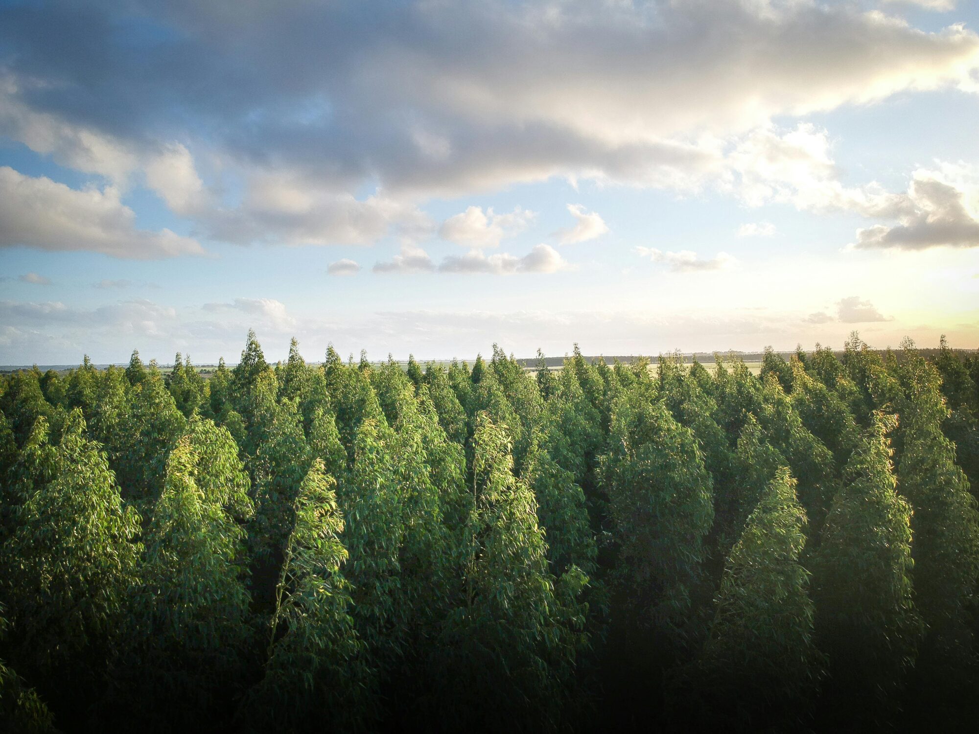
Forestry
Perform forest inventory by detecting dead trees, calculating biomass, and identifying fire risks. Increase precision in forestry tasks such as tracking tree species, detecting diseases, and assessing carbon capture. Manage forest sustainably more easily, and make informed decisions regarding your harvesting and conservation efforts.
Invasive Species Detection
Detect specific invasive plants or animals, even in large and complex ecosystems. Monitor the spread of these invasive species by mapping and analyzing the affected areas. Early detection and continuous overview enables you to perform targeted actions to prevent further spread of the harmful species and protect biodiversity.
Defense
Enables fast, safe detection of landmines and UXOs using aerial-mounted sensors. This supports efficient land release in conflict-affected areas, helping protect civilians and restore access to vital land.
All you need in one platform
The Biodrone Portal covers the entire workflow - from drone data upload to actionable insights, all in one place. This eliminates the need for multiple software tools, reduces manual work, and enhances the depth and usability of the analysis. Key features include image stitching, easy-to-use model training tools and integration of results into GIS-compatible formats for further use.
Upload aerial data
Gathered by drones, satellites or from aerial surveys.
Stitch images
Use the uploaded, overlapping images to create an orthomosaics over the area.
Analyze data
By using pre-trained or custom AI models, and export results in the desired format.
Applications
The potential applications of The Biodrone Platform are virtually limitless with its advanced capabilities of counting and categorizing any object visible in aerial images.
Object detection
Detect, count and classify objects such as trees or infrastructure. The output includes polygons for objects with one point for each detected object. The objects are color-coded by class and height measurements can be provided.
Area segmentation
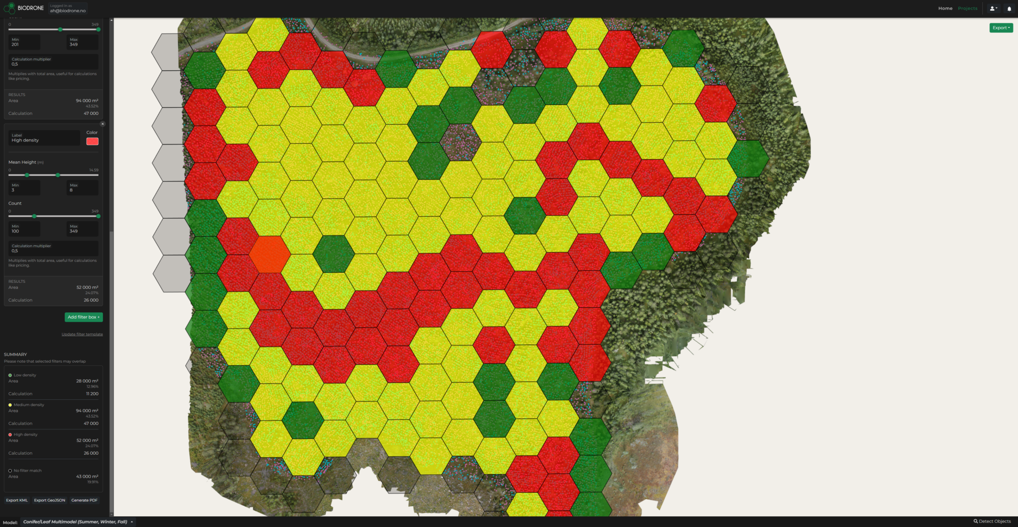
Map entire areas containing specific classes or objects, providing square meter calculations and additional data, such as object density and classifications.
AI-model customization
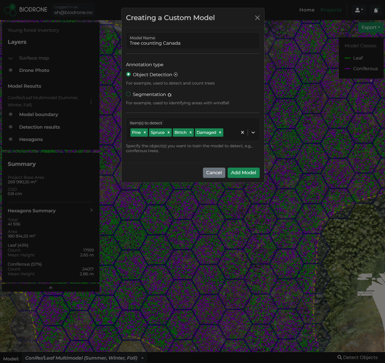
Train AI-models that can detect and track various objects in your image data, displaying results on the map as GIS layers with clear markers, class legends, and item positions for quick navigation and analysis.
Key features
Sensor Agnostic
Eliminate the needs for multiple platforms with end-to-end data processing that supports various aerial data, allowing maximum flexibility across different industries and use cases and eliminating the need for multiple platforms.
Automated Image Stitching
Upload overlapping aerial data from drones, satellites or aerial surveys, and let the platform automatically stitch the images into an orthomosaic, simplifying the photogrammetry process.
Train and Refine AI Models
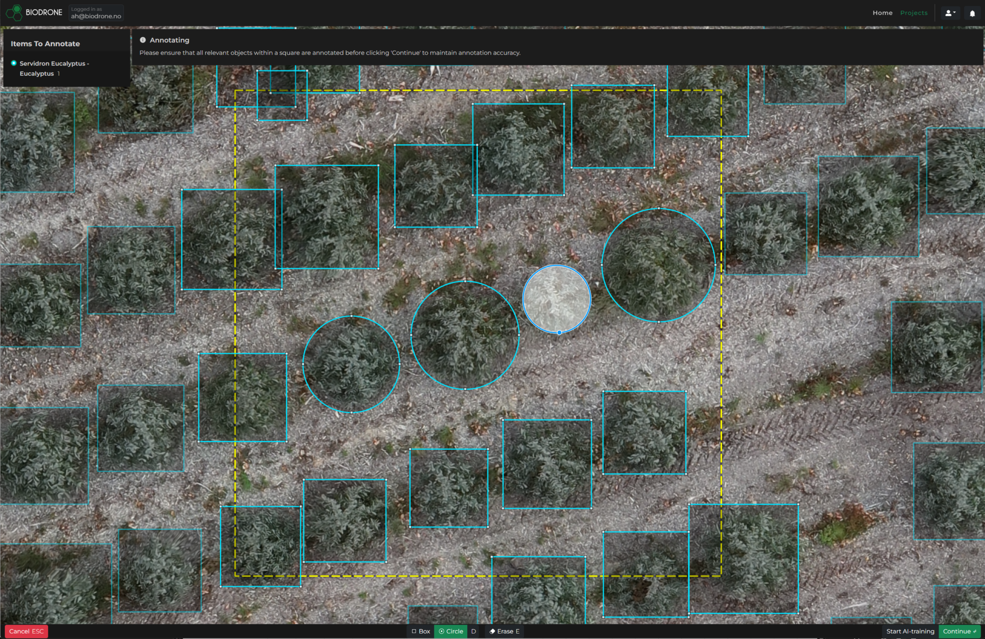
Effortlessly train new AI models with built-in annotation tools, allowing users to label objects and build tailored models without AI expertise. Continuously refine your models by training them on new data, ensuring your AI adapts and improves over time to meet evolving needs.
GIS-Ready Integration
Seamlessly export analysis results in widely-used formats like GeoTIFF, KML, and GeoJSON, ensuring smooth integration with GIS tools such as ArcGIS and QGIS for streamlined workflows and enhanced data usability.
Scalable & Secure
Built on AWS, the platform ensures high availability and scalability to accommodate growing data needs. Your data is protected through AWS’s secure infrastructure, with encryption and compliance with industry standards to ensure privacy.
User-Friendly Interface
An intuitive design streamlines model creation and analysis without the need for technical expertise. Automated processes reduce the time from data collection to actionable insights, enabling quicker, data-driven decisions.
About Biodrone
Biodrone is a Norwegian company specializing in drone services within the forestry industry. In the recent years we have been working in close collaboration with leading forestry organizations while developing the technology used in The Biodrone Platform. For our portal users, we offer support in data collection, annotation, and model training.
From ground to sky: How Biodrone uses DJI Matrice 350 RTK for forest mapping and management.
Available Subscription Plans
To use the Biodrone Portal, a subscription is required. It provides you with advanced AI training and detection tools for your projects, and also offers secure storage of your files.
Starter
- 15 GB cloud storage
- Up to 500 images per project
- 2 projects included
- Unlimited detections
- Unlimited AI model training
- Access to pre-trained AI models
Pro
- 50 GB cloud storage
- Up to 1500 images per project
- 10 projects included
- Unlimited detections
- Unlimited AI model training
- Access to pre-trained AI models
Business
- 500 GB cloud storage
- Up to 3000 images per project
- 20 projects included
- Unlimited detections
- Unlimited AI model training
- Access to pre-trained AI models and Digital Sample Plots (DSP)
Enterprise
Do you want a custom solution with unlimited access to all features? Get in touch with us for more information on how we can customize The Biodrone Platform to fit your specific needs.
How to unlock the potential of AI
1
Create your account
Create a user and choose your subscription plan.
2
Upload image data
Upload your aerial image data and stitch them directly in our platform.
3
Gain valuable insight
Analyze your data and generate precise results more efficiently.
Frequently Asked Questions
Are you ready to fuel your performance with data-driven insights?
Take your workflow and decision-making to another level of efficiency, simplicity and accuracy by processing your aerial image data in our all-in-one solution: The Biodrone Portal. Create your account today, or get in touch with us if you are interested in a customized solution.


